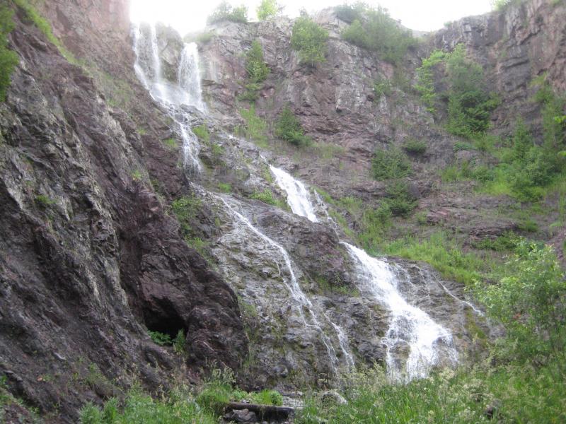


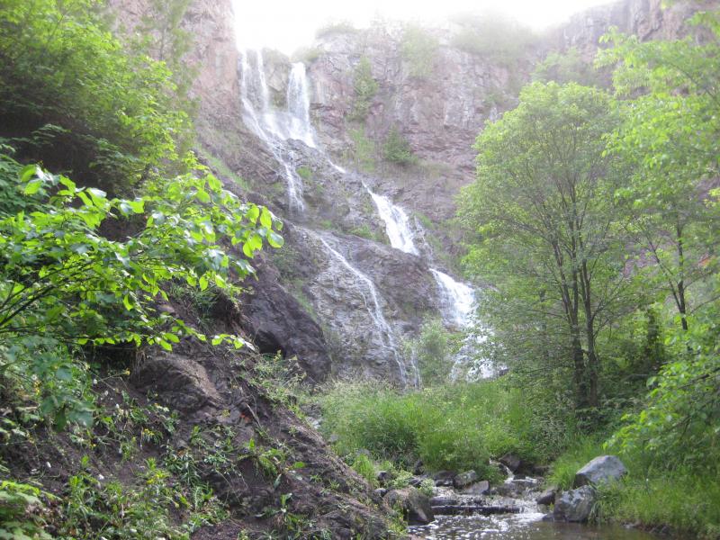

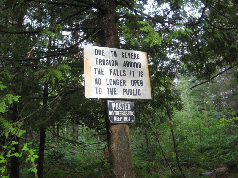
A wildly tall and impressive waterfall, Douglass Houghton Falls was once a popular destination for locals and Michigan Tech students alike. Crumbling cliff walls and numerous accidents, many of them fatal, pushed the land owner to cut off access. While the falls are still reachable by following Hammell Creek upstream from Lake Linden, the danger of a careless visit cannot be understated.
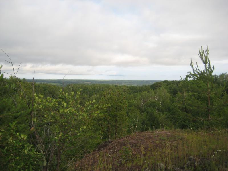
This waterfall is well over a hundred feet with several plunges bouncing off the sharp, volcanic rock. Steep walls make it difficult to reach the small drops in the meadow above, but a great view down towards Torch Lake can be made down the green creek valley. A small exploratory shaft is drilled into the side of the falls only a few feet above the creek. While it's hard to reach and dangerous to explore, this waterfall is one of the highlights of the Copper Country.
Directions
Right outside of Lake Linden, where Gregory Street turns into Cemetery Road before heading north up Trap Rock River Valley, park by Hammell Creek. There is an old drive-in theatre, now overgrown, on the east side of the road. Follow the creek upstream over a mile to the falls. Try to avoid climbing the cliff walls, as the crumbling walls have undergone serious erosion over the years.
-
Jacob Emerick
Apr 12, '09
I've heard rumors about it being an exploratory shaft, and it's shape and structure looks suspicious. I only crawled in a few feet, but it has a nice rounded top and goes pretty straight to be a cave.
-
elpeabod
Jan 13, '11
A few friends and I explored this shaft with a flashlight. It is a dead end, although thoroughly creepy. If you plan on exploring it, bring a light and watch your head.
-
Scott Borkowski
Feb 10, '18
That is a old copper mine.
Add to this discussion-
Jacob Emerick
May 16, '15
Behind the falls? Dang. That would be neat to crawl back to.
Add to this discussion-
Jacob Emerick
Aug 21, '15
Ah, interesting. Exciting that you got to talk to the property owner! Did he give you permission to visit the falls?
-
Mark Piotrowski
Dec 26, '15
Just saw this post...yes got permission and visited falls...will be going public in near future...
-
Rick Brown
Aug 5, '18
Since the June 2018 flood this route is impassable. Tried to find highland on the ridge and was unsuccessful. My advice is to try to get permission for the short route or find some other falls. Dead River Falls in Marquette is a nice hike. And the Presque Isle River hike in the Porcupines is excellent!
Add to this discussion-
Jacob Emerick
Dec 24, '15
Oh wow, that's pretty neat. Must have been very exciting to rappel down the gorge, with the waterfall (depending on the time of year) thundering down nearby.
-
Doug Bomberg
Jun 19, '17
I have in-laws from Lake Linden who said last week that the property had been acquired for public use. Unsure of its current accessibility, but look forward to its reopening. My fiance speeks highly of it from her access decades ago.PS If in the area, seek permission from the landowner and see the Natural Wall only a mile or so further northeast. The Wall, Houghton and Hungarian Falls, and Bare Bluff (up Bette Grise) are all fantastic exposures of the Keweenaw Rift Fault.
Add to this discussion-
Jacob P Emerick
Jul 6, '18
Thanks for the update, Scott!
Add to this discussion-
Jim DeGraff
Jul 4, '22
I've heard both names for the falls. Most locals call it Douglass Houghton Falls, but this is the second time I've heard someone call it Houghton Douglass Falls. What is your source for the second version of the name?
Add to this discussion-
Jacob P Emerick
Jul 15, '19
Hi Brian - I haven't seen or heard any update on the falls, so I'm assuming that it is still under construction. Also, based on Ahmeek Jim's comment above, I'd recommend avoiding the area while it's under construction. If you're looking for some good spots to visit in August, I'd recommend Hungarian Falls or, for a more rugged adventure, Montreal Falls.
-
Gloria Jean Davis
Apr 28, '20
I was trying to find my way there from the highway in mid-May 2019. I went on a dirt road with a small parking area just off the highway that had private property on each side, down to where the construction is. Tried "peeking" in, as I could hear the water running, but I could not get enough of a view through the trees to even see it. Wondering if it will be open yet this year...
-
Frank
Mar 23, '21
This site is now owned by the state and plan is to make it a veterans park. There was a dedication when the land changed hands but nothing has been done since that time which was now least a couple years ago. When last checked the DNR was waiting for money to allocated for development and that was before this shut down and they have not even done a engineering study on what the design of the park would be. I believe any construction that is being talked about was for a power line that was run though the property to head out to the Gay area.
-
Elizabeth In Snowland
Apr 9, '21
The falls can be accessed from above by parking on Hwy M26; about half way between Lake Linden and Calumet watch for a pine stand with a faded orange flag tied to a small pine on the east side of the road. There is a small trail behind the flagged pine that quickly skirts the creek and is about a 5 minute walk to the top of the falls. Exercise extreme caution since the drop offs here are sheer cliffs and very high. We were unable to descend to the valley floor due to the terrain and muddy, slippery spring conditions, but got some partial views of the falls from about half way down. Seeing the change from pine forest to enormous rift valley was truly marvelous.
-
D Sullivan
Apr 10, '21
Was there today and saw no construction of any kind . Trail had severe erosion was a mudslide even thou it’s “closed” numerous others there, the water level was high so falls were just glorious
-
L Conner
Aug 31, '21
Visited today... The faded orange flag Elizabeth described has been replaced by a string of colorful flags (we missed them on the first drive past). Google directed us to a private drive just south of the pull off and the owners have a sign up "falls 600 feet" and an arrow pointing north. Thanks for the tip Elizabeth! Nice easy hike, but definitely need to be cautious looking over the cliff's edge!
Add to this discussion-
Jacob P Emerick
Jul 17, '21
Awesome update, thanks Eric.
Add to this discussion