Several hours of daylight had slipped by before I finally reached the small town of Herman. Part of it was staying in Michigan Tech last night - staying up late with friends kept me sleeping well past the sunrise. And then there was the breakfast and slow drive out of town, too. When I eventually reached Herman and my first stop of the day it was comfortably past ten.
I wasn't too worried about the time. My knee was hurting and I didn't feel like pushing the miles today. If I could get a few basic stops in today before limping back to Wisconsin then I'd be fine. Well, 'basic' is a relative term. The first waterfall to visit was Upper Silver Falls, which is a lengthy walk along the southern stretches of Silver River in the hills of Herman.
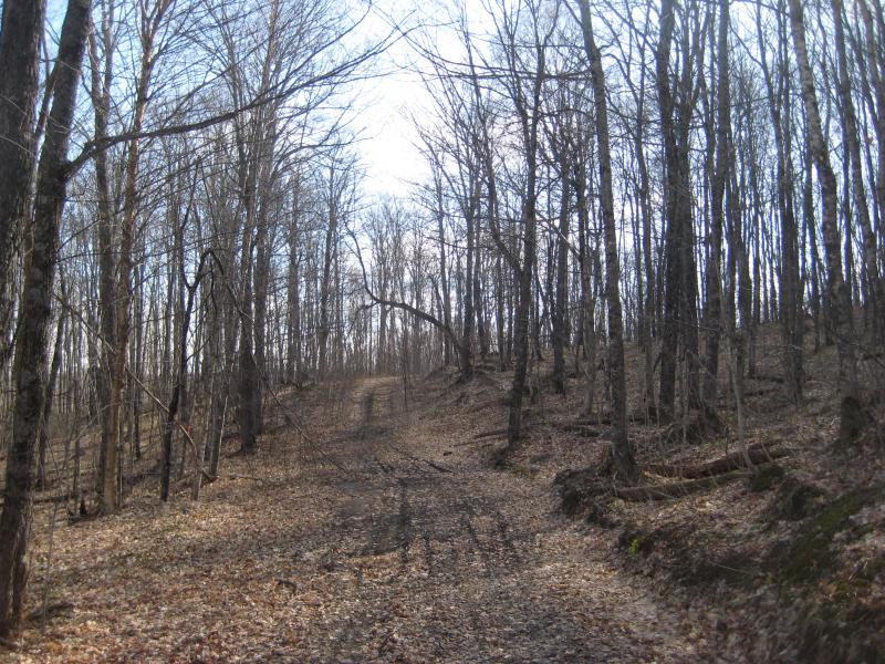
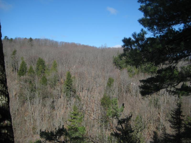
Bare trees along the track down
Parking at the road split near the old gravel pit, I started on the long walk down the two-track to reach the main waterfalls. It's driveable, but I didn't want to risk the still-soft spring ground. Plus if I parked here and walked down the track, following the river upstream past each of the five falls would leave me right back at my car for an easy exit.
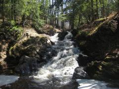
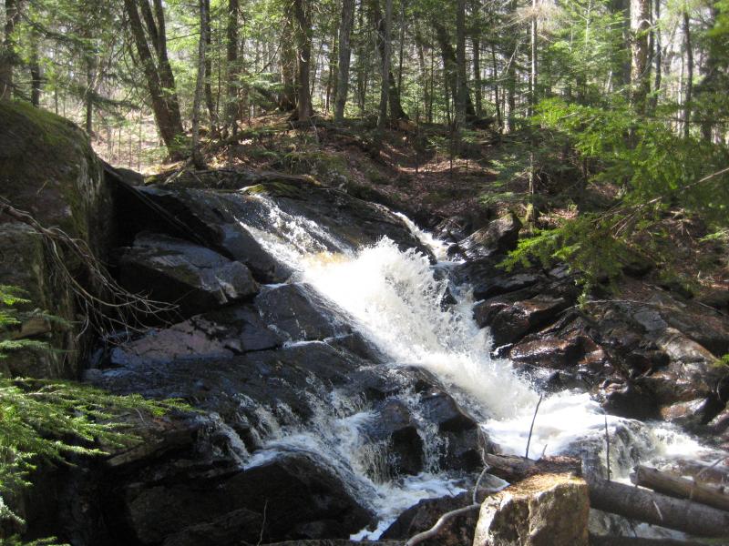
Thirty minutes later and I was standing at the top of the main waterfall, less than two miles or so downstream of Summit Road. It's an impressively tall one with lots of individual cascades, plunges, and enough rubble at the base to make for fun river crossings. The water was flowing strong today and created a white curtain above the top drop. Which got me rather excited for the upper drops on this visit.

Top plume of the lower falls
I had been to these drops several times in the past and had never seen the middle falls in full force. The middle ones are pretty neat, as the water slides over a smooth slant of solid rock for a few hundred feet before dropping straight down an eight-foot tall wall. However, when the river is low, like it had been on my previous visits, most of the river is channeled to the side, making the direct drop less an impressive waterfall and more a wall of dry rock. If the water was flowing stronger, maybe this one was looking better.
Crossing the river I headed upstream, slowly moving away from the river. There was a healthy half mile or so before the next drop so I felt comfortable walking through the clear woods instead of pushing through the riverside brush. Plus, I could cut out some distance by making a straight line. I wandered through the springtime growth, seeing sprouts of green making its way through the dead brown of winter, noticing things in the distance that would have been completely blocked during summer. Like the two-track that showed up out of nowhere and led upstream.
The track was not expected. I didn't think there was anything east of Silver River here, just woods and hills and maybe a few logging roads miles away. It sure made things easier. Unlike the track on the west side this one stayed pretty close to the river and made cutting to and back from the different falls either. Maybe this hike would be easier than the bushwhacking I had been ready for.

Clutter below the individual plunges
When I came upon the middle falls I was only slightly disappointed. The wall did not make a solid curtain across the river. Instead, the water pooled and poured out of a few lower sections to form different plunges. It was still neat to see, though I made a mental note to try to get out here during the snowier melt in hopes of seeing a more solid drop.
The next two drops were easy to reach thanks to the two-track, and soon I was back on Summit Road and making my way back to the car. My knee was feeling much better than yesterday and my next stop would be easy enough on it. Once I got to the car, drove through Herman, and parked on the side of Herman Road on the way back to L'Anse I felt ready and determined. I was finally going to see the real Dault's Falls.
Dault's Falls and I have a rocky relationship. The creek runs along portions of Herman Road and past several houses, making it annoyingly easy yet uncomfortable to visit. I had found one drop a short distance below a driveway, maybe a foot or two tall at most, and called that the waterfall. But there was something that felt off about it. I had been back a few times and hiking a short distance up and downstream and never found anything else, yet something still felt off.
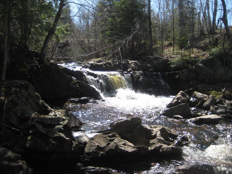
I headed down to the creek near the same old little drop and started downstream. After a few hundred feet the water twisted away from the road and began to swing around the back of a house. I wasn't sure how much further I wanted to go, with a house between me and the road, when a crest of water showed up ahead. Once I dropped down with the creek and looked back it was obvious that this, not the little drop upstream, was the real waterfall.

The real Daults Falls

Calm pond downstream
It was a perfect drop. The creek funneled together and then shot out of a small chute, plunging over rocks and rapids with white fury, before dropping into a long, calm pool. This, this was a scenic spot. That house nearby worried me, though. I took some photos, paused to enjoy the view, and then headed back up to my car with a quick step.
An early afternoon sun was now shining down on me and I debated heading back to Wisconsin. I had made the stops I was aiming for, my knee was an okay shape, and the thought of making it home in time for dinner was tempting. Instead I pulled off of US-41 at Canyon River Falls. Eh, it's an easy stop, and maybe there'd be something new to see here.
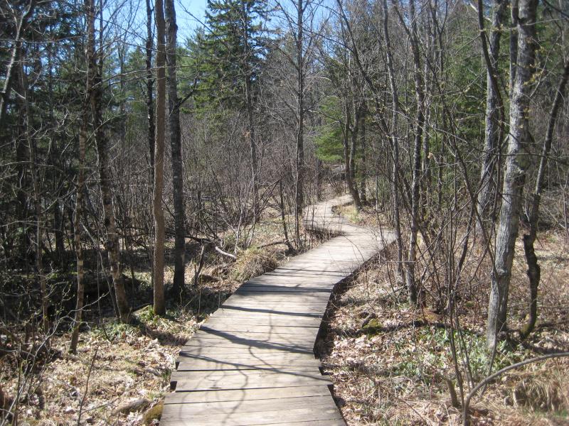
A familiar wooden footpath
This was my fifth visit to this site and everything had that wonderfully familiar hue. The winds on the footpath were expected, the roots over the path to step over, and the bubbling Bacco Creek and how it curved away before flowing into the Sturgeon River all felt comfortable. Thanks to the lack of snow and my increased daring I was able to get a pretty cool angle on the main falls, too.

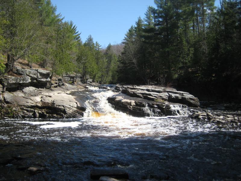
Water level with Canyon River Falls
I ventured beyond the falls, skipping over the end of the path and following the top of the steep slate banks. When I got to the middle drop, near the cliff-jumping area, I meandered around for some time looking for a good way down. There really isn't one. Well, I could dive down and take a shot from the water itself. Other than that I didn't see any good way to get level with that little drop.
The path is well-defined to and past the cliff-jumping area and goes all the way to the lowermost falls. Which is called Upper Falls because of maps or something. I didn't stick long here, just took a quick photo and headed back. I had wasted enough time down here on past visits, hoping to find another drop in the swamps below due to a coordinate error, and didn't feel like hacking through thick brush today.
Dramatic colors of Upper Falls
Returning to the car was a slow, careful slog. My knee hurt, this was the last hike, and I had plenty of daylight to both walk and drive through. This was definitely the last hike. Sure, Bacco Creek was nearby and might have drops, and it'd be cool to see Plumbago again, and both Jumbo and Duppy Falls were along the way home, but I was done. I got my weekend in, saw plenty of cool things, and was now certain that my knee needed some good rest and probably a doctor's visit. It was time to go home.


Comments (0)