Thick fog cloaked most of my drive up to Marquette. An audiobook kept me going for much of the dark drive through Wisconsin, some random story with just enough plot, but after I crossed over the Menominee the gloomy lighting from swirling fog had me struggling off sleep. When things began to light up near K.I. Sawyer I was relieved. Soon I would be hiking, and the combination of cheap coffee and the cool spring air should shock me awake.
I pulled off of Country Road 553 near Marquette Mountain and stepped out into the morning air. It was cold, a welcome jolt to my system, and it was also surprisingly wet. The temperature was already around forty and the thick snow pack was shedding moisture into the already moist air. I grabbed my camera, an extra bottle of water, and a few granola bars before heading along a packed track in the woods.
Logan wasn't with me on this trip. He had thoroughly disappointed me a few weeks ago on Sugarloaf, where I had to carry his over-tired body over miles of thick snow, and I didn't want a repeat of that misadventure. Today it was just me for now, slowly climbing up the south face of Marquette Mountain, jumping from the paved road to animal trails until I made it to a bare bluff overlooking the city in the north.
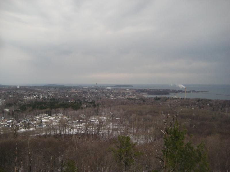
North view over Marquette
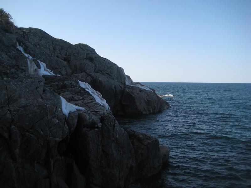
Marquette Mountain was just a side venture for now. I played around along the bluff and made my way east. The bluff eventually gave out and I was forced to push through thick brush without much of a path. Since the easy way had given way to bushwhacking anyways I poked a way south to get a partial view of the ski hill. There was a lot of snow over there, as there should be on a ski hill even after the season.
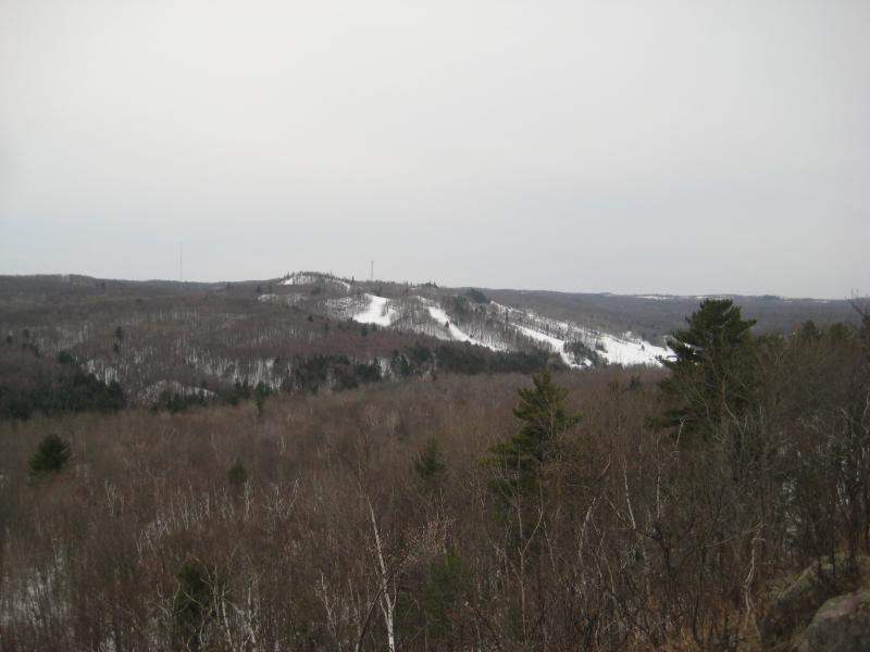
The ski hill to the south
From this point I began to tiptoe through the woods. There is a prison on the other side of the river further to the east that I had no interest in wandering into. I didn't know if their boundaries extended over here, or what their security was, but trespassing on something like was not appealing. There was no need to worry, though. When I came down off the mountain I bumped right into a large parking lot with a few cars in it. Fishermen. There was a drive that came in from US-41 in the east and enough recreational traffic to ease any concerns of mine.
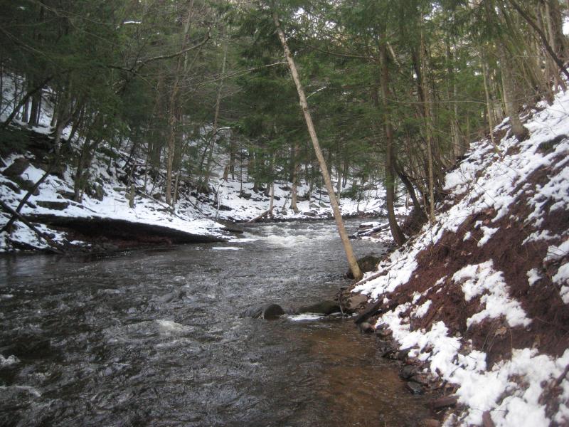
More curious now I wandered right over to the river. There was supposed to be waterfalls along this stretch, between here and 553. I wanted to see how much flow the river would have on this spring day and what kind of river bed I'd be dealing with. Carp River was deep and flowing fast, with muddy banks clogged with dead grass, and this hike looked pretty sucky already. At least there was an old gazebo rotting on the far bank to lighten my spirits.
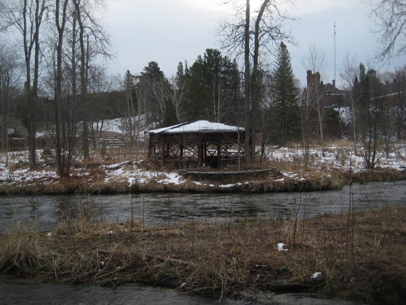
Old gazebo across Carp River
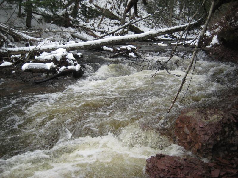
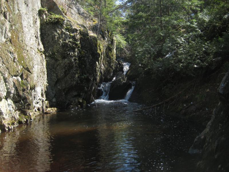
There were a few beaten footpaths that followed the river upstream, mostly likely made by decades of fishermen, and I started the hike west. The paths didn't last long. Carp River carved a deep gorge here lined with conglomerate rock and they couldn't keep up with the changing terrain. With little choice I headed down into the river and tried my luck on the slick riverbed. Even with the spring melt there was still exposed rock on sections, or at least stretches where the water was only a few inches deep.

Tough climbing along the waters edge

Busy sliding rapids
Following the river was a taxing ordeal. My boots were quickly soaked through with the icy water, and my knees and hands grew dirty and wet from crawling along steep banks when the river did get too deep. At one point in the hike, while I was stooped under an overhang and shuffling through ankle-deep water, I felt something in my right knee pop. There was no pain at the time, just a weird tingle, though I started to feel a dull soreness within an hour that did not bode well.
After an hour of tough river walking and passing by a handful of cross fishermen I gave up. There was no drops along this stretch more than a few inches tall. If there was a Marquette Mountain Falls, or Lower Carp River Falls, or whatever they were called, it was little more than a few sets of mild rapids. I was cold and sore and done looking. I headed up the bank, found a bike trail that was half-thawed, and followed it back to 553.
I wasn't done with this area yet. Passing my car and crossing the highway I started up a muddy, snowy track that led up the western ridge of Mount Marquette. A few vehicles had tried this drive already this year and had left deep ruts of muddy water surrounding the hard-packed snowmobile tracks. Sticking to the hard pack with only the occassional sunk foot helped me make quick time over the ridge and where I suspected Morgan Creek lay.

Penstock crossing
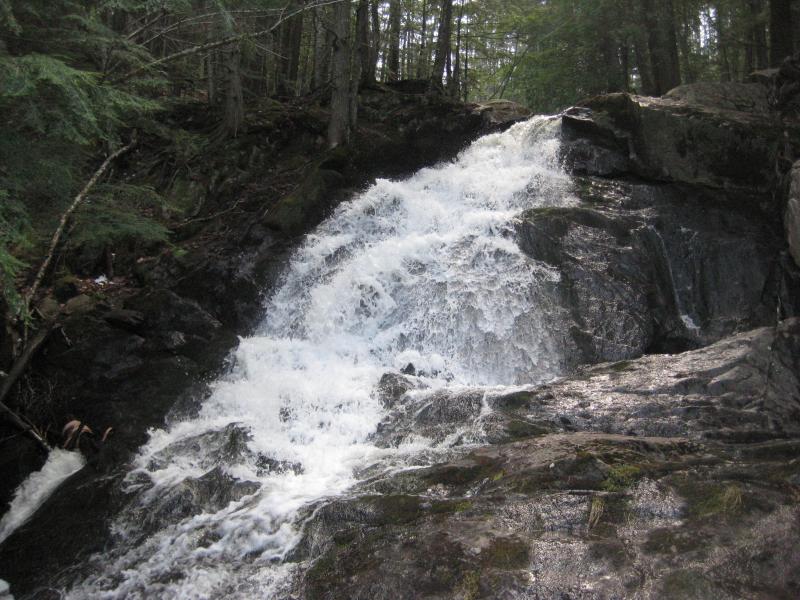
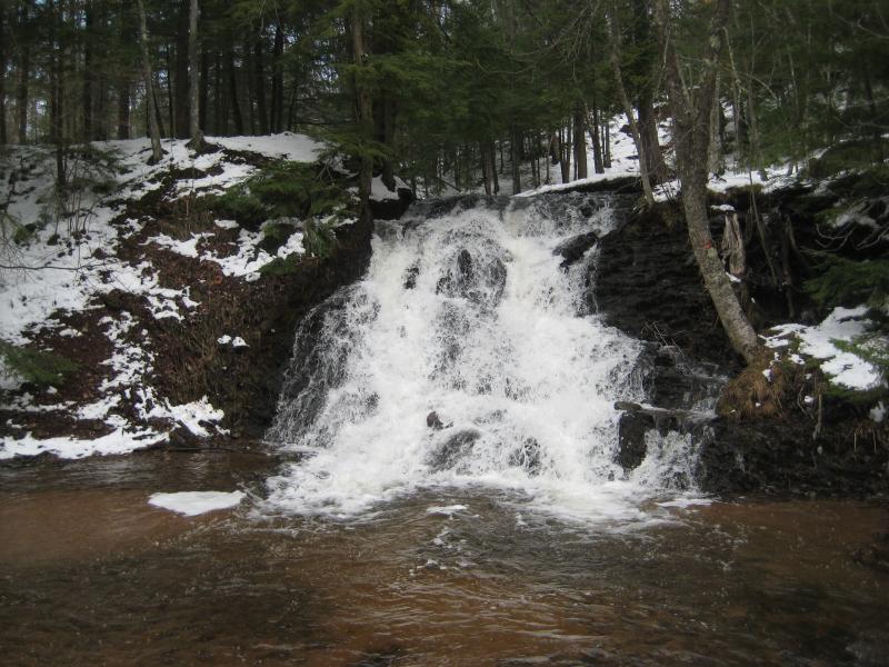
A narrow trail that crossed over the penstock for Carp River helped confirm my suspicions. I followed the path to Morgan Creek and then took the creek a short distance downstream to a loud rushing curtain of whitewater. Morgan Falls never disappoints. I stood next to the loud waterfall, letting the noise and soft mist rush over me, and slowly made a circle around. Last time I was here I was stuck on the far side of the river, unable to get more than a glimpse of this impressive drop, so I took my time here today.
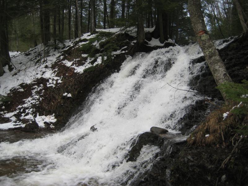
Sudden curtain of whitewater
Voices coming from above broke my peace. A couple had driven up the road and was here to check out the falls before going fishing on the Carp River. I wished them luck and left. Backtracking to the snowy road and following it down to my car made for a slippery and boring walk, but at least I had found one good waterfall today.
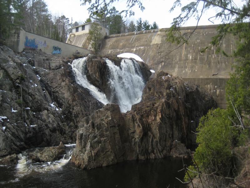
It was time to meet up with my hiking partner. Kathleen and I had already been on a few hikes, camping at Big Erick's and exploring the Yellow Dog, and now that she was living in Marquette it only made sense to drag her along for some more adventures. We met up by the busted Tourist Park Dam and I drove us up Wright Street in hopes to find a new way to Forestville Dam.
Last year Katie and I had found a very tall waterfall shooting out of an overflow pipe at Forestville Dam. We had approached it from the south, though, and I had to shimmy under a dripping tar penstock to see the drop. There had to be a better way. Today I'd be trying from the north bank, which would not only avoid the dripping tar but also offer a better view of the waterfall.
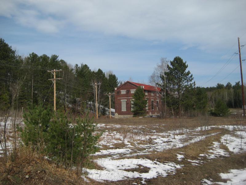
Old brick power station
I parked near the gated drive just offset from Ontario Ave and we headed over on foot. In retrospect I could have parked over by the small 'Wright Street Falls', but I didn't realize it at the time. We walked the sandy road on foot and some came upon a large old power station, looking ancient and regal in front of a small clearing. Beyond that was a tall bank of sand that led up to some powerlines. We huffed up the sand and, more on a whim than anything else, headed left along the powerlines.
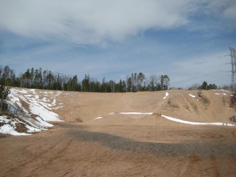
Sand bank promising a fun climb

Narrow muddy track through tall trees
A few paths led along the powerlines, winding and re-crossing, and then one twisted and headed into the woods. This was just in time - the powerlines crossed the Dead River and we may have ended up on the south bank again. Instead we turned with the path and followed it between towering pines. I was getting pretty confused by now, but at least the walk was pretty.
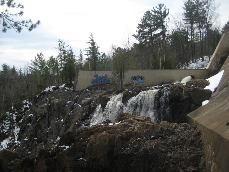
We made some educated guesses at a few forks and ended up at a small clearing next to a large body of water. This, this had to be Forestville Basin. I confirmed by jogging over and seeing the orange buoys warning watercraft to steer clear of the dam. There was a little wooden bench here that Kathleen took adventage of while I meandered over closer to the dam. Sure enough, the overflow pipe was spewing out over jagged rock. We had found Forestville Dam Falls.
Looking across at the falls
Large rocks blocking the waterfall
The view from the north bank was rather interesting. The overflow pipe was dumping water onto the a rocky bluff, where the water pooled and streamed for a dozen feet before dropping out over the falls. This almost seemed like an attempt to make the waterfall look natural and was pretty neat. Also, there was a rocky knife that blocked the bottom half of the falls from this bank. I had to crawl down the crumbling bank and circle downstream a bit for a better view, almost reaching the vantage point I had stood at a year earlier.

Lonely bench near the reservoir
After I was done playing around on the rocks below I came back up to Kathleen to check on here. She was content to stay up here away from the steep banks, content to look over the basin and down at the falls. I couldn't blame here. Aside from the cabins along the basin and a few splotches of graffiti on the dam this area was quite peaceful. We had other places to visit, though. We backtracked along the trail, under the powerlines, down the sandy bank, and past the old power station, and drove off for a quick lunch.
A sub from Jimmy Johns and the long drive towards Big Bay rejuvenated me. Between the early morning, tough hike on Carp River, and growing knee pain I had started to consider calling it early today. Even the easy hike to Forestville Basin had forced me into an awkward hobble. Kathleen and I chatted as I drove up 550, trying to figure out our next stop. I didn't have any particular plans, had only wanted to give her a fun day of exploring, though now I also wanted to make sure we tackled relatively gentle hikes.
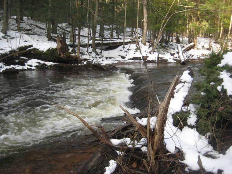
We were almost to Big Bay before we finally made up our mind. Alder Falls seemed like a scenic and easy stop. I was able to drive all the way up to the parking area too, something that was a pleasant surprise. I had assumed that there would be snow plugging up the track. We parked and I swung out of the car and almost fell. My damn knee was really stiffening up.
Engorged Alder Falls
Pushing the pain away I walked with Kathleen down the steep path to the lower falls. We spent a lot of time at the first drop, admiring the gushing spring flow over the tall rock wall, before eventually climbing up and heading to the upper drops. When we neared the third drop beyond the sharp bend I decided to climb up the western bluff. I wanted to climb up, get a good view, and then drop down on the other side near the uppermost drop. Kathleen didn't feel like taking such an ambitious route. I gave her cursory directions on how to get back to the car and we split ways.
Climbing up that western bluff was really hard. There are two bluffs near the third drop, one on each side of the river, and the western one is a good twenty or more feet taller than the other. My knee was weak and trembling, a good sign that I had done some damage to some ligaments, but I kept climbing anyways. When I reached the top I looked around, saw Kathleen on the eastern bluff just below, and got a real kick out of the awesome view of Lake Independence beyond the bare trees.

Lake Independence in the distance
When my hiking partner turned and headed into the woods towards the car I also started a descent towards the upper waterfall. The woods were thick and scratchy with young red pines along the way, though at least it wasn't as steep a drop. For the most part. I had to veer far upstream and backtrack to reach the last waterfall. When I reached it I took a few quick photos and headed through the woods with a heavy limp and a lean towards to where I suspected the track was. I found the sandy track easy enough, spotted the car, and made it there with little problem. Kathleen wasn't there.
Her route was half the distance of mine. How did I beat her back? I shouted a few times and waited for a reply - nothing. Getting a bit worried I headed down to the trail to the first waterfall, thinking that she had returned there, and didn't hear or see anything. Ignoring my knee I rushed up the eastern bluff, where I had last seen her, and shouted some more. I headed into the woods in the direction I had last seen her and kept shouting for her. A few minutes into the woods and she popped out, looking annoyed, and asked why I was yelling. She didn't think she was lost at all, just taking her time.
More than a little annoyed at her we returned to the car and drove back down to 550. The very least she could have done is yelled back if she heard me. If she had gotten turned around in the thick woods there is nothing but swamp and hills for a few miles, more than enough for someone to get lost for hours or more. I debated calling it a day, fuming and hurting, when I remembered there was one last stop we could make. And it wouldn't be a long hike at all.
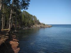
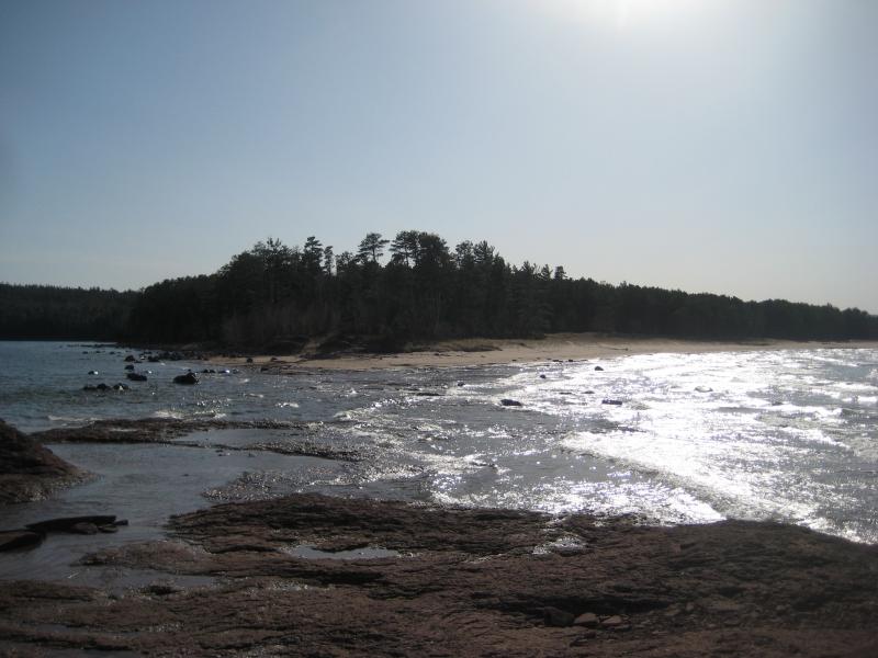
Little Presque Isle was a familiar spot for me. I'd been here with Katie before and we walked the beach and thought about hiking out to the island. And Logan and I had been here a few months earlier, though he was too tired to attempt the ice crossing. I've heard that the water is never more than three feet between the shore and island but had yet to try wading across. Today seemed like a good enough day.
We parked and headed to the point, wind gusting through the trees and the cold foggy air of the morning forgotten. The temperatures had to be a balmy sixty. Still, I knew the water would still be frigid from winter and I didn't want to tempt the crossing barefoot. I pushed ahead with a false air of bravado, ignoring the water as it first seeped in my boots, then poured in through the top, then lunged up past my knees with each passing wave.
Looking back at the mainland
A few hundred yards and I was sitting on the warm rocks of Little Presque Isle, stripping off my sodden socks and rolling up my pant legs. I watched Kathleen struggle across with a certain satisfaction. There were two reasons I opted for this hike. It was relatively short, as the shoreline is only about a mile long, and I'm much taller than Kathleen. The water barely made it to my thighs. On her, who had annoyed me so much at Alder Falls, the waves were over her waist. Maybe she'd even topple over.
Still, I helped her ashore and we stretched out on the warm rocks and let the sun and wind dry us. My ill towards her wasn't that strong. After a leisurely fifteen minutes we slowly got up and looked around. A trail stretched up past us and promised easy access to the rest of the island. It was time to explore Little Presque Isle.
The trail wasn't so easy on our bare feet. Some stretches were covered in pine needles and more with gritty crushed rock. I hobbled along on hurt feet and an aching knee and my hiking partner followed almost as awkwardly. When we reached the black rocks on the far shoreline it was almost a relief to be on flat, uncovered ground that did not gouge at our soles.

Down on the black rocks
I lingered here, unwilling to head back on the harsh trail. These rocks were also warm, the waves were cool to watch, and there was no real rush to return. Yet there was. The sooner I got back to Wisconsin the sooner I could get Katie's professional help for my knee and relax in comfort. That four hour drive just sounded very unappealing as I sat on the black rocks and gazed over Lake Superior and had boring, casual chats with Kathleen.


Comments (0)